Dangers of Hydrogen Sulfide (H2S) and the Louisiana Sinkhole

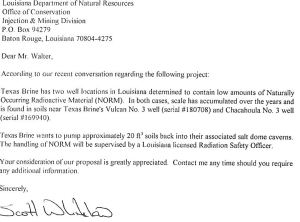
According to Assumption Parish Police Jury;

Texas Brine has reported to parish officials low levels of H2S coming from the cavern well. DNR, Shaw representatives, and the OEP Director went to the site to validate Texas Brine’s reading and found no levels of H2S on their monitors. Readings will be repeated in the morning when Texas Brine flows the cavern well again. Should H2S be present at that time, appropriate actions will be taken. We will keep you updated.

Please note that no H2S readings were picked up on the community air monitors.

http://assumptionla.wordpress.com/2012/12/06/130-p-m-texas-brine-reports-h2s-at-cavern-well/

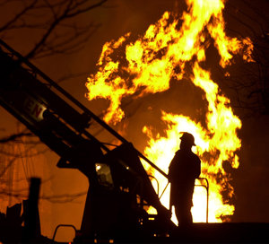
Also, take note that they also announced that Lake Oxy 3 has grown another Twenty Five Feet, so I thought it might be nice to know a little more about H2S and this was also requested by one of my readers. Thanks to Wiki, and Nora for the information contained in this article.

Hydrogen sulfide (British English: hydrogen sulphide) is the chemical compound with the formula H2S. It is a colorless, very poisonous, flammable gas with the characteristic foul odor of rotten eggs. It often results from the bacterial breakdown of organic matter in the absence of oxygen, such as in swamps and sewers; this process is commonly known as anaerobic digestion. It also occurs in volcanic gases, natural gas, and some well waters. The human body produces small amounts of H2S and uses it as a signaling molecule.

Hydrogen sulfide is slightly heavier than air; a mixture of H2S and air is explosive. Hydrogen sulfide and oxygen burn with a blue flame to form sulfur dioxide (SO2) and water. In general, hydrogen sulfide acts as a reducing agent.

Small amounts of hydrogen sulfide occur in crude petroleum, but natural gas can contain up to 90%.[7] Volcanoes and some hot springs (as well as cold springs) emit some H2S, where it probably arises via the hydrolysis of sulfide minerals, i.e. MS + H2O → MO + H2S

http://en.wikipedia.org/wiki/Hydrogen_sulfide

Presence of H2S in oilfields

Oil and natural gas are the products of the thermal conversion of decayed organic matter (called kerogen) trapped in sedimentary rocks. Methane (CH4) is the main component of natural gas, comprising 70 to 90%, while other gaseous hydrocarbons, butane, propane, and ethane, account for up to 20%. Naturally occurring contaminants present in natural gas and which have to be removed at natural gas processing facilities include water vapour, sand, oxygen, carbon dioxide, nitrogen, hydrogen sulfide (H2S) and rare gases such as helium and neon. High-sulphur kerogens release H2S during decomposition, which stays trapped within the oil and gas deposits and is frequently encountered in oilfields, often to high levels, as in west Texas (Schlumberger, 2007).

During oil exploration and production, H2S may enter drilling muds from subsurface formations and is also generated by sulphate-reducing bacteria in stored muds. Other sources of natural H2S emissions are volcanoes and geothermal sources such as hot springs. Natural gas, or any other gas mixture which contains significant amounts of H2S, is generally termed ‘sour’ if there are more than 5.7 milligrams of H2S per cubic meter of natural gas. This is equivalent to approximately 4 ppm by volume (http://www.naturalgas.org/naturalgas/processing_ng.asp).

Although the terms ‘acid gas’ and ‘sour gas’ are often used interchangeably, a sour gas is any gas that contains H2S in significant amounts, whereas an acid gas is any gas that contains significant amounts of acidic gases such as CO2 or SO2. CO2 by itself, therefore, is an acid gas but it is not a sour gas.

The H2S is removed (‘scrubbed’) from the sour gas by a process commonly referred to as ‘sweetening’ at what are termed desulphurization plants. Removal of H2S is normally done by absorption in an amine solution, while other methods include carbonate processes, solid bed absorbents (including solid desiccants like iron sponges) and physical absorption. The ‘amine process’ (also called the Girdler process) is used in 95% of US gas sweetening operations (http://www.naturalgas.org/naturalgas/processing_ng.asp).

In this process, sour gas is passed through a tower containing the amine solution, which has an affinity for sulphur and which absorbs it. Two main amine solutions are used: monoethanolamine (MEA) and diethanolamine (DEA). The emerging gas is virtually free of sulphur compounds and the H2S can be removed from the amine solution, allowing it to be reused to treat more sour gas.

The presence of H2S in an oilfield and, if exposed to the gas during oil and gas production, its possible impacts on human health, is a potential concern for potential UGS operators. H2S is a toxic, colourless gas that is odourless at high concentrations but has a smell of rotten eggs in low concentrations. Because H2S is heavier than air, it tends to accumulate in low-lying areas. It is an extremely poisonous gas and a few seconds of exposure in concentrations of anywhere between 750 and 10,000 ppm can prove lethal to people and animals. However, the effect of H2S depends on duration, frequency and intensity of exposure and the susceptibility of the individual

(Schlumberger, 2007). http://www.glossary.oilfield.slb.com/Display.cfm?Term=hydrogen sulfide

Research conducted at the University of Southern California Medical Facility has established nervous system damage can occur even at concentrations in air as low as 1 ppm (Chilingar & Endres, 2005).

H2S is hazardous to rig workers and is also corrosive, causing sulphide stress-corrosion cracking of metals, which may require costly special production equipment such as stainless steel tubing. A recent study concluded that H2S “will eventually destroy the integrity of both the steel and cement relied upon to prevent gas migration, including abandonments performed to the current standards of the DOGGR [Division of Oil, Gas and Geothermal Resources]. The corrosive conditions of hydrogen sulphide are well known, and have defied engineering solutions.”(Chilingar & Endres, 2005). Whilst this may be an extreme conclusion, it highlights the importance of proper procedures and monitoring of the presence and effects of H2S on plant and infrastructure. H2S is a recognized problem, with established procedures to mitigate it.

Incident at Gasfield, Chongquing, China

An incident in China illustrates the potentially deadly effects of H2S release during production from a gasfield. The disaster took place at the Chuandongbei gas field in Gao Qiao town in the north eastern part of Chongqing province. The incident involved a gas well blowout, which occurred at 10:00 pm on Tuesday, 23 December 2003 and resulted in the release of natural gas and H2S. According to press reports, the accident occurred as a drilling team was working on the 400 meter deep well and sent toxic fumes (sour gas – a high concentration of natural gas and (H2S) shooting 30 metres out of a failed well (UNEP: http://www.uneptie.org/pc/apell/disasters/china_well/china.htm#impacts )

The China Daily newspaper described the tragedy as “the worst of its kind in China’s history”.

“The poisonous gas hovering in the air made an area of 25 square kilometres a death zone, as many villagers were intoxicated by the fumes in their sleep”. Worst hit was the village of Xiaoyang next to the gas well, where 90% of the residents were killed, “many having died in their sleep or were too old to escape” (WSWS, 2003).

The incident was reported in Lloyd’s Casualty Week for 23rd Jan 2003 as follows: “officers investigating a gas leak which killed 243 people in western China have arrested three oil company workers on suspicion of dismantling safety features and mishandling drilling equipment……one of China’s worst industrial accidents…..the investigation has forced the resignation of a vice president of state owned China National Petroleum Corporation. …….The accident sent a deadly cloud of poisonous hydrogen sulphide over nearby villages in a poor mountainous area. Villagers died in their sleep or were struck down while trying to flee. More than 9,000 people were treated for injuries and 60,000 were forced to evacuate the area. Hospitals reported…… 396 were still being treated for injuries, several of them in critical condition.”

http://nora.nerc.ac.uk/7877/1/OR07023_Vol_1.pdf

Open Letter to the Residents of Bayou Corne

STINKHOLE

It has come to my attention that some of the local resident’s of Bayou Corne are angry with many of us “Dry-Landers” not understanding what it means to live in a ‘bayou”.

One such sentiment is, “The beef the locals have with us cyber visitors is they say the Lake OXY 3 was there all along. Just covered in floating grass. And as part of the oil skimming deal they take up the grass exposing black oily water. But it is not new water they say. So they say sinkhole isn’t expanding. We are just seeing more swamp due to grass removal and tree die off.
They are getting peeved that we don’t get their view point.”

My response is this… a bayou is defined as, “a marshy arm, inlet, or outlet of a lake, river, etc., usually sluggish or stagnant. or any of various other often boggy and slow-moving or still bodies of water.”

Also I have been in the swamps many times over the last 35 years with friends all over Louisiana, so I do have a clue as well.

But I have never been in any swamp or bayou that is 145 ft. deep. That is more of a lake, and so is the reason I named that small area, “Lake Oxy 3”.

This in no way implies that there wasn’t water in a bayou to begin with, as that would be silly, but since the subsidence, (or slough off as Texas Brine and DNLR are calling it as well as slurry), the natural fresh (fresh is a stretch I know, but even stagnant is considered fresh), waters and evidently brine have co-mingled to create “Lake Oxy 3” and I named it that to remind everyone of Texas Brine and it’s customer Oxy, or Occidental.

Nor have many been claiming that the actual tear in the earth is getting larger, because we can’t see it any better than ya’ll can, so we rely on the updates just as ya’ll do.

What most of us, and LDNR are so concerned about is the rising waters. It is that time of year when the waters rise, which of course then intersects with all other surrounding waterways, canals and bayous, thereby carrying all of the crap rising out of the sinkhole, cave-in, whatever you want to call it to your back doors. The rise in the salinity of the surrounding waters is a major concern but even more alarming is the hydrocarbons that Texas Brine just got fined for not containing properly.

I quote the last 4th Amendment to Last Order, :

ORDER$

http://dnr.louisiana.gov/assets/OC/BC_All_Updates/ORDER_DIRECTIVES/CP_4thEmergDec_2012.pdf

These are our concerns as well. Is this what you folks want to be surrounded by? As the waters of Lake Oxy 3 rise, so too shall all of the environmental and human damages also begin to rise. Even the Police Jury seems to understand as evidenced by their last statement;

“A resolution was approved requesting that Texas Brine consider providing the option of a buyout or relocation to the residents of Bayou Corne.” and ” A resolution was approved to object to any and all extensions, contingencies, or modifications to the orders invoked by the Department of Natural Resources onto Texas Brine specific to the sinkhole.”

http://assumptionla.wordpress.com/2012/12/04/920-a-m-police-jury-resolutions/

As per the all of the above reasons, I urge all of you still in Bayou Corne to heed the Jury’s resolution. I hate letting the oil and brine and natural gas people win, and I truly believe they should be forced to pay double for all properties and relocation, but this is truly a lost cause. There is no way for Texas Brine or anyone else that will be able to contain the TPH’s, the chloride’s or the TDS’s once the waters reach that magical level when this is no longer a highly localized matter, but an area wide contamination.

So forgive all of us “Dry-Landers” for not showing more compassion and understanding when we report on just Texas Brine and LDNR, such as;

LOUISIANA DNR COMPLICIT IN SINKHOLE COVERUP!

https://freedomrox.wordpress.com/2012/12/02/louisiana-dnr-complicit-in-sinkhole-coverup/

Then to hear that your neighbors over in Doyline are dealing with their own explosive crisis.

“Weather could complicate the transfer of roughly 6 million pounds of explosives that were haphazardly stored at an industrial site in northwestern Louisiana and led to the evacuation of a small town, a state police spokeswoman said Monday.” is just beyond belief and heart breaking.

Forgive us for our ignorance, but please understand our passion for getting the right thing done, and whether you know it or not, doing the right thing by all of ya’ll as well.

As Kenny Rogers said in his song, “Sometimes…you have to know when to hold ’em, know when to fold ’em.”

Ultimately, that choice is up to you, the people whom live in a paradise turned nightmare.


LOUISIANA DNR COMPLICIT IN SINKHOLE COVERUP!

LOUISIANA DNR COMPLICIT IN SINKHOLE COVERUP AND MISINFORMATION!

 by: FREEDOMROX

 uniongeyser1111-224x300

 As most know, I normally do not concern myself with anything other than the larger picture. As a researcher, it is far more likely that I tie together what others do not and in ways that seem a little extreme…that is, until proven correct. “Always let Occam’s Razor be your guide”, was one of the first lessons I ever learned…after “Always eat your vegetables, whether you like it or not!”

But sometimes, you come across something so reprehensible that you must bring yourself down to earth and just report the little things, and allow the chips to fall where they may. Such is my task at this time.

Regarding the Louisiana Sinkhole in Bayou Corne, Assumption Parish, La., there has come to my attention a most corrupt and sickening amount of data that leads me to an inevitable conclusion.

The Louisiana Department of Natural Resources, (DNR), has been complicit in a coverup, and in attempting to hide it’s own culpability in the disasterous results of its own actions, and the catastrophic consequences visited upon the people of Louisiana, especially those of Grand Bayou, (again), and Bayou Corne, as well as anyone else whom may be affected in the future by this Department’s negligence.

When asked for details of the Texas Brine Oxy Geismar #3 cavern size and dimensions, we get all kinds of answers. It’s about the height of two Empire State Buildings, or it is approximately….. but never a straight answer. Only once have we obtained anything near a straight answer, but that was reported by the Advocate, to wit;

“The cavern roof is at 3,400 feet underground, and the cavern extends down to 5,650 feet. The roof is 150 feet across. Its base is 310 feet across.”

http://theadvocate.com/news/3692114-123/drilling-on-schedule-at-assumption

That is 2, 250 ft. in height of storage space with a base of 310 ft. across at the bottom, but according to what few diagrams we get, narrower at the top at 150 ft. About 205 ft. mean width. But we do find in the August 13, 2012 permit issued to Texas Brine, LLC from the LDNR, that the top of the Salt Cavern is at approximately 3400 ft. below the surface of the earth. Whew! Glad that is sorted out. Also, from the Advocate we know that the bottom of the cavern is at 5,650 feet, right?

Wrong!

TEXAS BRINE DEPTH 

Add the above and you will come up with 4, 850 ft. of piping, that is further away from the original borehole, but this equates roughly to the top of the dome being at 3450-3500 ft. So it seems we are good here. Look Below for the Operational Plan of Oxy Geismar Well #3A.

 TexasBWell3-AThe Operational Plan of Oxy Geismar Well # 3A.

 TexasBSaltCavern

Actual depth of the Salt Cavern as of last Report

http://dnr.louisiana.gov/assets/news_releases/Texas_Brine_Permit.pdf

It seems that LDNR and Texas Brine knows that the bottom is at 4241 ft. and not 5,650 feet now, (a loss of 1409 ft.), and either something is pushing up the bottom of the Salt Cavern, or is compromised by an outside influence, and have reported it in their documents, so please don’t jump the gun.

“Assumption Parish President Mike Waguespack stated,We knew when they got into the cavern that the bottom had been compromised.”

Waguespack explained that “the bottom obviously had infiltration from somewhere that originally wasn’t there, originally it was brine.” http://www.examiner.com/article/hydrocarbons-breaching-sinkhole-cavern-bottom-oil-75-atop-hole

Of course we all know from the west side it is in the collapsed zone with voids, but there is an unknown force upon the east side as well. But they will not say what, exactly, is the source. Why? Because it is METHANE AND OIL MIGRATION. Why would they not tell us this simple fact? Because it means that everyone involved is LIABLE! PERIOD. EVERYONE!

As everyone knows if they have read my articles that I believe there is a Methane Migration Zone stemming from the April 20, 2010 BP Well Blow Out in the Gulf of Mexico, and I still do believe that it is a firm motivator and engine of destruction in this ongoing saga, but other more local factors exist as well.

But…. It is a well known and established fact that Methane Migration is a REALITY. Allow me to prove this assertion, please.

“Last September, Chesapeake Energy CEO Aubrey McClendon declared to a Philadelphia energy conference that the problem of methane migrating through the ground near natural gas drilling sites had been fixed.  “Problem identified. Problem solved,” he told an industry-heavy crowd at the Philadelphia Convention Center.

Nearly a year later,  Bradford County resident Michael Leighton is worried about the flammable gas seeping into his woods.

Leighton lives about a half-mile from a Chesapeake Energy well that Pennsylvania’s Department of Environmental Protection suspects leaked methane gas through holes in its casing. For more than two months, gas has been gurgling into creeks and wetlands on Leighton’s property. That’s in addition to the methane in Leighton’s water well, and the methane in his basement.”

The full horror story is at: http://stateimpact.npr.org/pennsylvania/2012/07/30/in-northeast-pennsylvania-methane-migration-means-flammable-puddles-and-30-foot-geysers/

This story goes on to report about a Methane Geyser; “Soon, someone discovered a bigger problem: a geyser shooting methane-infused water more than 30 feet in the air. “That’s when all hell broke lose,” said a neighboring landowner — who, like others State Impact Pennsylvania talked to about the Union Township problems, requested anonymity, due to ongoing negotiations with Shell over damages and leasing.”

Video of alleged Methane Geyser in N. Pa.


As if in the grip of a real life disaster movie, the town of Hutchinson, Kansas experienced its own “gas migration”,


The gas crisis that rocked Hutchinson, Kansas

“A geyser erupted on Hutchinson’s east side. The nearby railroad was shut down. And a sink hole appeared.

Authorities posted barricades on streets, sealing off an evacuated downtown. Shelter preparations began at the Kansas State Fairgrounds.

In a rat-a-tat sequence, those events shook Hutchinson between 10:45 a.m. and 4:30 p.m. on Jan. 17, 2001.

They were only the start. Tragedy visited the next day.”

1991-2011kansas15013_embedded_prod_affiliate_80

“Old brine wells, the legacy of salt-solution mining, dotted Hutchinson, including one beneath the Hahn home. Gas was rising up through those wells, so authorities combed records at the Reno County Historical Society and Hutchinson Public Library to determine the location of old salt plants and wells.”

“Ratigan at first was skeptical that gas migrating from Yaggy Field was causing eruptions in Hutchinson, but soon became convinced that was the cause.

ONEOK would acknowledge later that approximately 143 billion cubic feet of gas escaped from a leak in the S-1 cavern.”

http://www.hutchnews.com/Todaystop/Sun–explosions-reflection–1

Please read the whole story at the link provided to understand the true scope of the disaster.

Salt%20Dome%20Hutchinson%20Gas%20Explosion

Anatomy of A Salt Dome Methane Release in Hutchinson, Kansas

These two stories are only a minor sampling of the proof of Methane Gas Migrations, and an excellent reason for obfuscation of the true issues in Assumption Parish.

That, however does not in any way excuse the manipulation of information that was to come next by the DNR in Louisiana.

In a federal lawsuit filed in New Orleans on August 13, 2012, alleged that, “a salt cavern failed, which Texas Brine Co. was using to store radioactive material, a byproduct of the drilling industry.
     The class claims that Texas Brine knew the cavern walls were liable to breach as early as January 2011, but failed to warn the public.
     “The public was not warned in January 2011 or any time thereafter or prior of the potential danger resulting from the failure of this cavern and the general public had no knowledge of the storage of the radioactive material in the cavern,” the complaint states.”

 “In early September 2010, defendant began reworking the cavern well, milling a section of salt higher than the existing cavern roof, at 3,400 feet deep, to see if the upper strata could be mined. This area extends for about 100 feet through the well casing above the cavern roof.
     “On January 21, 2011, Mark J. Cartwright, President of Texas Brine Co. Saltville informed the Louisiana Department of Natural Resources (LDNR), via letter, about a failed integrity test of the cavern and suspicion that the cavern may have breached the Napoleonville Dome’s outer wall. These problems with the cavern led to the cavern being plugged in June 2011. The area milled in September 2010 may be the source of the salt dome breach.
     “LDNR records show that Defendant had been examining the cavern’s wall at least since June 2010.”

http://www.courthousenews.com/2012/08/13/49239.htm

(ASIDE) Why on earth would Texas Brine try to brine the roof of the Salt Cavern? It is stated as a fact that the top of the Cavern is at 3400 ft., so why try to mine at less than 1200 ft. above this level? Common sense should have overidden greed in this case, and the DNR knew it as well!

How Salt Brined caverns are formed

http://www.soltechprojects.ca/wp-content/flash/gas.php

Up until present day, any news story even approaching this subject was given a 20 ft. of Naturally Occurring Radioactive Material, (NORM), was deposited in the Texas Brine Oxy# 3 Salt Cavern in 1995.  This is not true at all, and DNR knows it isn’t.

 DNRLIEII

As stated, the document does not say 20 ft. of NORM, but 20 ft. cubed which is about a cubic yard of NORM contaminated material, and even this seems to be a lie as well, since all fracked materials are considered Technologically-Enhanced-Natural-Occurring-Radioactive-Materials, (TENORMhttp://www.epa.gov/rpdweb00/tenorm/

Evidence exists that Texas Brine has been putting this amount back into three different salt caverns since 1994. Not just at Napoleonville either. They own three other mines at Bayou Choctaw as well, and got permission to use these caverns as ‘Dual Usage’ Caverns as well.

Dual Usage means brining for salt, and then depositing radioactive shale created from brine solution mining bak into the same well to settle on the bottom..

Is this enough proof for a court of law to litigate? I truly believe so, and the evidence just keeps on piling up, and none in favor of LDNR. They have shown at the least that they obfuscate, prevaricate, and even outright lie, to protect their cash infusions from oil-soaked petro dollars contributed by Super-Corporations that dominate the area as well as the Gulf of Mexico entire.

Maybe it is time to investigate the finances of these Corporate Cronies, Elected State Officials, as well as the Elected Representatives of these Districts to see just where they may have received financial favor and campaign contributions… That is covered under the PATRIOT ACT isn’t it? If not, then surely State and Federal RICO laws apply?

The truth of the matter is, that as far as any of us are allowed to know, is that Grand Gulf Energy, and Golden Gate, Inc. and its unnamed 60 percent partner, is the only drilling operation that could allow such a migration of Methane and Oil.

We should all be looking for who else was drilling prior to these interests, and before the sinkhole developed, if any. Otherwise, we have a culprit on the hook.

As Linda Cooke states over three months ago;

“I was told the more correct term was investigatory well, or a well which would be drilled down to the suspect brine cavern so investigating what might be going on could be done. And it was 3,400 feet just to the top of the brine cavern! I had no idea it was that far down.

As I understand it, this “relief” well will be drilled starting late this week, and I don’t know how long it will take to get down that far. Nor what will happen when they get there. It will be interesting.

I have some friends who have evacuated their home in Bayou Corne and are now living in their RV a few miles away. The husband recently had five heart bypasses, and they’re not too happy about the whole situation.”

Read more: TecheToday.com – Baja St Martin

I have so much more that I can share, but this article is too long as it is. I will wait with baited breath to see how many pick up on this most important addition to the ongoing soap opera known as, “As the Bayou Churns”

More Later….

TXBRGNRI

TXBRDNRII

TXBRGNRIII

 TBDNRNORM

http://tinyurl.com/9t9sbjc

Louisiana Sinkhole’s Explosive Potential Massively Understated! Part II

Louisiana Sinkhole’s Explosive Potential Massively Understated! Part II (Gulf of Mexico)

 by: FREEDOMROX

It seems when it comes to hydrocarbon recovery and the greed it engenders; then there are no boundaries that the Big Oil Corporations will not cross.

Credit: http://wattsupwiththat.com/2010/05/01/the-gulf-oil-rig-explosion-on-the-scene-photos/

It has only been a little over two years since the worst oil rig disaster and spill in human history took place in the Gulf of Mexico and perpetrated by British Petroleum, (BP), TransOcean, and Halliburton. Although the Halliburton-owned Boots & Coots Recovery Company was purchased just 11 days before the incident and claims the spill to be cleaned up; actually the environmental impacts have still not truly revealed themselves, and the financial devastation to the local fishing industry and tourism numbers in the billions of dollars.

Many do not also know of the other Gulf disasters that were taking place at the same time as the BP Macondo fiasco, such as the Assumption Parish Well Blow Out.

http://ireport.cnn.com/docs/DOC-481102

or that a Tug vessel hits abandoned gas well in Barataria Waterway on July 27, 2010, which highlights the haphazard way that wellheads are abandoned. (Video included)

Many today believe the MC 252 and MC 296 wellheads are still leaking at the old Macondo Well sites. This writer believes so as well, but since officials refuse to send any ROV’s to do an actual inspection of the sites under nearly a mile of water, then we are left to speculate and watch from the surface. Several more spills have been noted in the area in 2011, and 2012.

Recently, it was reported in bold type, “BP slapped with Massive Fine and Pleads Guilty to 11 Felony Counts”, Penalized with 4.5 billion dollar fine, benefiting only the SEC and the Federal Government, and looking at truly staggering sums to come in civil litigation, as well as having all Govt. contracts suspended, then you would think that would curb any further very risky exploration wells in the Gulf of Mexico.

Sadly the opposite is true. BP has recouped the amount of the fine and more before the fact by selling off a few of it’s less profitable assets, to the tune of 5.5 Billion dollars, and forged ahead with more dangerous projects in the even deeper waters of the Gulf of Mexico. It also has been reported by the Huffington Post that BP Plans $5.9 Billion Share Buy Back After Criminal Fine In Aim To Boost Lagging Stock, so this way they can buy back their own stocks for pennies on the dollar. It seems their lust for profits over shadow their contrition and shame for their part in the voluminous “Dead Zone” in the Gulf, where no living organism can survive in the depleted oxygen areas.

BP is not the only big player that is taking Deepwater Oil Drilling to the extremes, and one very near the Macondo Blow Out. Meet W&T Offshore, Inc. (W&T) “is an independent oil and natural gas producer, engaged in the acquisition, exploration and development of oil and natural gas properties primarily in the Gulf of Mexico and Texas. W&T has acquired rights to explore and develop new prospects and acquired existing oil and natural gas properties in both the deepwater and the deep shelf, while at the same time continuing its focus on the conventional shelf.” This is according to Reuters company profile.

It goes on to say that W&T is drilling at MC 243, which is practically next door to MC 252, but drilling directly into or next to the Whiting salt dome.

“Mississippi Canyon 243 field is located off the coast of Louisiana, approximately 100 miles southeast of New Orleans, in 2,552 feet of water. The field area covers Mississippi Canyon block 243, with a single production platform on Mississippi Canyon block 243. The Company has 100% working interest in the field. During 2011, cumulative field production through was approximately 21 million cubic feet equivalent gross (124 billion cubic feet equivalent gross). This field is a supra-salt development with 17 productive horizons at depths ranging to 9,850 feet. As of December 31, 2011, 17 wells were drilled, of which eight were successful. During 2011, production from this field, net to its interest, averaged 3,150 barrels of oil per day, 288 barrels of NGLs per day and 11.4 million cubic feet of natural gas per day, for total production of 5.3 million cubic feet equivalent per day (32.0 million cubic feet per day).” (Reuters)

Please visit the link above to find out all the areas of the Gulf of Mexico that W&T is exploiting. It is an eye-opener.

Also, according to Offshore Magazine, “Eight companies – Anadarko, BP, Shell, Chevron, BHP Billiton, ExxonMobil, Statoil, and Petrobras – out of 63 with production in deepwater GoM are expected to account for 93% of the growth from 2012 to 2016.

Recently, Helix Energy Solutions Group reported an oil discovery at the Danny II exploration well at the Bushwood field in Garden Banks block 506, approximately 145 mi (233 km) offshore from Galveston, Texas, in the Gulf of Mexico. The Danny II exploration well encountered more than 70 ft (21 m) of net pay. The Danny II exploration well was drilled to a TD of 14,750 ft (4,496 m), in a water depth of approximately 2,800 ft (853 m). The well is being completed and probably will be developed via a subsea tieback to Helix’s East Cameron block 381 platform 31 mi (50 km) to the north in 370 ft (113 m) of water.

The article goes onto to explain that, “Hess’s Tubular Bells project is making use of Williams’ proprietary Gulfstar FPS system to serve as the central host facility. Williams will construct and install its Gulfstar FPS in 4,100 ft (1,240 m) of water in MississippiCanyon block 724, roughly 135 miles (217 kilometers) southeast of New Orleans.”

This is what it looks like, so I feel I must ask…


What could possibly go wrong?

I know many are asking, “Why should this concern me? They have been drilling there for years!”

That is partly why everyone should be concerned. According to official records, there are over 50, 686 holes in the Gulf of Mexico, and counting.

 http://robslink.com/SAS/democd33/borehole.htm

Please visit the interactive website above to appreciate the enormity of the situation.

Remember all of these holes are perforating the Continental Shelf in a very vulnerable area.

Additionally, according to BK Lim, In a letter dated 14 January, 2011 that was sent to Congressman Fred Upton, Chairman House Committee on Energy and Commerce, and Congressman John Shimkus Chairman Subcommittee on Environment and Economy,  BK Lim warned the congressmen and their committees about the current state of the sub-seabed in the Gulf of Mexico (GOM). In the document, an in-depth assessment of the emergency was provided. It explains why action must be taken immediately. The evaluation of the emergency in the Gulf conducted by Mr. Lim appears credible and is based on his 30 years of experience analyzing the geologic structure of both dry land and underwater drilling sites for major oil industry companies and leading geohazards contractors such as Fugro Geodetic (M) Sdn Bhd, TL Geohydrographics Sdn Bhd, and RPS Energy Pty Ltd.

The vaporization of enormous amounts of methane hydrates on a scale not seen before, the release of stresses between the lower and upper crust resulting in the abnormal occurrences of low magnitude, shallow earthquakes adjacent to the New Madrid Fault, the sub-seabed underground erosion in the vicinity of the shelf edge undermining the slope stability with possible tsunami-generating, giant, submarine landslides,” said Mr. Lim.

“Water sample analysis conducted independently by EcoRigs shows a positive correlation to BP’s oil spill samples. “The presence of fresh BP MC 252 crude oil in surface waters 2 to 14 months after the well was reported to have been capped suggests that crude oil from the BP DWH MC 252 field may have found new pathways to the seafloor.”

http://real-agenda.com/tag/the-faults-and-salt-domes/

Many links and good videos at this site, and an excellent expose by Luis R. Miranda and the Gulf Rescue Alliance.

Add to this then, the report by Sherwood Gagliano, “EFFECTS OF NATURAL FAULT MOVEMENT ON LAND SUBMERGENCE IN COASTAL LOUISIANA”  

Which states, in part; “The most prominent and active area of submergence and land loss lies seaward of the Golden Meadow Fault Zone, a series of interconnected cracks extending 130 miles across the land from the west bank of the Mississippi River near Empire, Louisiana to Atchafalaya Bay, extending 35,000 feet below the surface, and studded with massive sub-surface pillars of salt.”

This illustrates how the coast is literally disappearing due to fault-induced subsidence. Please take note of the copious amount of fault lines all through Southern Louisiana, East Coast Texas, and next to and under the gullet of the Mississippi River. I also take note of the ones near Grand Bayou, La. as well.

Yes, you knew I would have to come back to the Louisiana Sinkhole and Lake Oxy 3. According to all of the documentation above and in my possession, I am still whole-heartedly convinced that methane is traveling up the Miocene, and finding purchase in and above the alluvial aquifers, which are reaching as far north and west as the Bistineau and Minden Salt Domes. Instead of just the Assumption and Grand Bayou Parish’s residents being in extreme danger, it seems very probable the whole Gulf Coast is in dire straits and more geologically unstable than even the West Coast of California.

For more information on the recent events at Assumption Parish and Lake Oxy 3, please see my recent article,

MEANWHILE DOWN AT THE LOUISIANA SINKHOLE, and LAKE OXY 3

Can we really afford another Gulf killing incident in the pursuit of petro-dollars? Are we as a people so weak that we will not stand up to the Corporations and say, “NO MORE!”?

Will we as a people stand idly by while the whole Gulf Coast slides into the Corexit and Oil stained waters of what is left of the fragile and beautiful eco-system that was a staple of our economy?

If just the 4.9 billion dollar BP fine was used to put solar panels on top of every home, with batteries,then our so-called oil and gas energy dependence would halve immediately, and current sources of oil would be all that is needed. In the Twenty First century, no longer should we be held hostage to the whims of corporate greed at our own and our environment’s expense.

MEANWHILE DOWN AT THE LOUISIANA SINKHOLE, and LAKE OXY 3

MEANWHILE DOWN AT THE LOUISIANA SINKHOLE, and LAKE OXY 3

By: FREEDOMROX

As most know by now, an event took place at the Louisiana Sinkhole on November 27, 2012. A “Burp” occurred and sent oil and debris to the surface after a four minute long seismic event.

http://tinyurl.com/d29ftl4

According to the Assumption Parish Police Jury;

An event occurred at the sinkhole around 11:30 pm today which is being considered as a “burp”.  Vegetative debris and hydrocarbons came up from below the sinkhole.  A few trees in the southwest corner did fall in however most of the debris came from below the sinkhole.  Texas Brine removed all crews from the sinkhole and is checking the boom surrounding the area to make sure everything is in tact.”

HOW WAS LAKE OXY 3 CREATED?

Unlike Lake Piegneur, this was not a breach of the actual cavern over a lake. Actually, quite the opposite. This area was bubbling normally with the natural methane creep inherent in any oil field in Assumption Parish, La., every once in a while bubbling to the surface as “swamp gas”, but just after the BP Macondo disaster began a continous flow of methane to fill the lower subsidence areas traveling through the Miocene shale, according to my own research. But if any dispute this assertion, then who could be responsible for the copious amounts of methane that is pressuring the Throat Seep Plug? More on that in a moment.
This was a marsh area subsidence that caved in next to the Napoleonville Salt Dome, whose west side caverns have been breached, (according to Authorities), http://tinyurl.com/9dg8fgw and water has entered to form a lake from the surrounding swamp water into the subsided (sinkhole) area. What is not explained is how a lake was created, especially if there is a breached cavern capable of holding millions of gallons of liquid, and a 5150 ft. borehole.

This is what I believe actually happened.
All of the land and trees and other materials that have fallen in created a plug approximately at a narrowing of the funnel of the subsidence area at about 650 ft. below the surface of new Lake Oxy 3. Yes, I have named the New Three Month Old Lake, and the obstruction that created it, and sustains it.

The original Texas Brine Drill hole exceeds 5150 ft., but that does not account for the newly formed lake. A drill hole that deep, and then collapsed 550 ft., and now over eight acres wide, would continuously drain for quite a long while, especially if a brine cavern has collapsed. So why is a lake there now?

It is known as a Throat Seep Plug. Seep, because it has allowed crude oil and hydrocarbons to come to the surface of the newly formed lake, while not allowing very much surface water to drain into the bore hole beneath. It is slowly draining water, while also slowly seeping methane and hydrocarbons, (oil), to the top. An equal exchange normally.

Unfortunately at the depths the Texas Brine, LLC. well bore was at, (according to Officials), has somehow allowed access to the Big Hum strata level, hence all the readily available oil. Over 85, 000 gallons has already been skimmed, and recovered, and from the looks of it, another 5,000 gls. is now at the surface and more bottled up below.

Again, the throat seep plug, or to make it easier, try to think of it as a drain that is clogged. Although the throat is clogged, a back pressure caused by methane gas, hydrocarbons, and liquid oil builds up underneath over time to the point the pressure finally blows a tiny part of the plug, (clog), away and a burp is caused. Anyone that has ever used a plunger at the kitchen sink or toilet bowl knows exactly what I am speaking of.

It’s an albeit small back pressure geologically, but is more than enough to pop loose some of the plug and to bring it, (piece of the plug), and other materials to the surface. It also gives an outlet to the oil which is the second engine of pressure from under the dammed up plug. Methane being the first.

Again, I must stress that it has been determined that Big Hum alone cannot possibly account for the high levels of the methane that has spread out over several Parishs now, and which is desperately seeking a release valve. The weakest surface area that is the closest to that methane and hydrocarbon pressure just so happens to be the plugged subsidence area, (i.e.sinkhole, and Lake Oxy 3 above).

With twin sources of motivating power working underneath the plug, then it is only a matter of time before the whole plug is violently expelled and a geyser of methane produced pressure and oil will clear the throat, (like a plumbing drainpipe).

This is actually a very good thing that has happened with this burp, (in the short term), as it postpones the inevitable explosive removal of the subsidence plug. But, this is only a reprieve. Sooner or later, the pressures underneath will clear the plug. A burp will become a belch, until it finally, explosively, regurgitates the contents blocking the throat. Gross, but accurate depiction.

Why would anyone be concerned that a sinkhole may “throw up”?

Because there are wellheads, and pipelines very nearby.

Any more subsidence, seismic disruptions greater than already recorded, or explosive forces could easily rupture anyone of the natural gas, propylene, (DOW), or oil pipelines. Further away, but not by much, we have ethane, butane, and other hydrocarbon pipelines to consider.

Unfortunately, since we know there is a breach in the west wall of the Salt Dome, (who knows what chemicals have mixed underneath the plug, still swelling), and we have a drilling rig fracking at a roughly forty five degree angle on the east side to the west side of the whole salt dome far underneath between five thousand, (turn) and then down another 7500 ft. allowing even more methane to fuel the pressures, then I would not be surprised if the Aussie’s are not indirectly responsible for this…. “

If Grand Gulf had drilled on the West Side, then they actually could have abated the Sinkhole, but since pulling natural gas and oil from the west and to the east and not knowing where their actual Frack “bombs” will be, then I really wonder if they are surprised to find that they are not getting anywhere near as much Methane or oil as expected.

 See, I ran the numbers, and if they are coming up correctly…then to get the amount of gas that is bubbling up everywhere reported in Assumption Parish and Grand Bayou, and the pressure pushing against the plug’s bottom at say 550 to 600 ft, since they (Officials, DHS, Shaw, and Sandia), claim the bottom is at 450 ft., then Texas Brine or someone is lying about how far they drilled.

 Mathematically speaking, if the Big Hum, Cris IV-V, Marg Vag, Cib Haz, etc…. If every single one of them were punctured…then that would account for the amount of methane pressures we have noticed, and been reported. If true, then my methane migration theory of the Gulf of Mexico Miocene shale creep is incorrect, and I would have no problem with new information updating and even demolishing my own theorems. That is what is called “science”. But if I am wrong, then that means someone is lying.

Why you ask?

Because that would require a Texas Brine, LLC. bore hole of at least 9,750 ft. straight down. This is accounting for pockets and for what travels along the shale with the hydrocarbons underneath and west of the Salt Dome. This is also taking into account that there is nothing to limit the North/South migrations.

Either that or the Hecox ‘Frack Out’ was much more explosive than reported, and has blown a hole in the shale downwards over a thousand feet.

Otherwise, there is another source of methane and unknown. The only other one that we may look at other than the Gulf of Mexico Miocene Migration Zone lies only at one place, and from one known drilling source, and that is Golden Gate Petroleum from Australia, and their unnamed and mysterious partner.

http://www.asx.com.au/asxpdf/20120113/pdf/423rd6pcrj913j.pdf

 (Click to enlarge)

Now who would possibly be able to drill over 12, 000 ft. and release this amount of methane and hydrocarbons underneath?

http://tinyurl.com/bucgefr

Hmmmm. Seems we need to be asking a few questions from our Australian friends, don’t you think?

More as it becomes available….

Louisiana Sinkhole’s Explosive Potential Massively Understated!


Louisiana Sinkhole’s Explosive Potential Massively Understated!

PART I

By: FREEDOMROX 

The various threats all of us are facing posed by the mammoth issues in Louisiana and the Gulf of Mexico, are spinning completely out of control. The consequences are far reaching, phenomenal, and highly volatile.

Instead of weaving this update one into another…this time I shall take it one area at a time, this time focusing on just the Napoleonville “Sinkhole”. If any doubt the veracity of any of the claims I make, please rest assured a link will be provided for each and every salient point, normally by scientific entreaties, video, or news sources, as well as the usual authorities.

BAYOU CORNE SINKHOLE:

Much has happened since my last article. The so-called “sinkhole” has now grown to over eight football fields in size with daily seismic activity. Although close to 85, 000 gallons of oil have been removed from the surface of the lake it has become, the water is still slick black with oil.

The flyovers show us that the surrounding swamp water has invaded and is overflowing the sinkhole contaminating the surrounding swamps, as well as methane invading both the Louisiana and Mississippi Aquifers. Several wells have been drilled in an attempt to flare off the methane, but most clogged, and one well being drilled into the cap rock of the Salt Dome was shut down when Hydrogen Sulfide was discovered the day before Thanksgiving.

http://enenews.com/watch-officials-call-state-police-sinkhole-after

The bottom of the “sinkhole” has risen over fifty feet, indicating a sub-pressure gas or fluid.

This is born out by the Itasca Consulting Group;

“Dr. Will Pettitt, Principal Geophysicist at Itasca Consulting Group, has reviewed the seismic data recorded overnight on November 20/21. Long-period seismic tremors and micro-earthquakes have been observed, similar to those defined previously by Dr. Steve Horton of CERI/USGS, and recorded mainly on station LA08 closest to the sinkhole. The long-period seismic tremors are postulated to be caused by gas and/or fluid movements through the rock collapse zone below the sinkhole on the edge of the salt dome. Micro-earthquakes of this nature are typically associated with small-scale rock movements, and again are believed to be occurring in the collapse zone. The source of both of these event types continues to be investigated by experts.”

http://enenews.com/international-experts-gas-andor-fluid-moving-below-giant-sinkhole-are-thought-to-be-causing-new-tremors

It has also been found that this is not the first time residents of Bayou Corne have had to be evacuated due to escaping gases.

Magnolia, Grand Bayou, south Louisiana (USA)

“The Magnolia Facility operating at the salt dome is located in a sparsely populated area at Napoleonville, about two miles from Grand Bayou, south Louisiana. In 2003, a cavern gas storage facility was constructed in the dome, operated by Entergy Koch/Gulf South. On Christmas Eve/Day 2003, only six weeks after operations began at the facility, around 30 people were forced from their homes by a natural gas (Methane) leak that led to the release of about 9.9 Mcm of gas in a matter of hours.

Investigations revealed that the gas escaped from a crack in the casing of a well near the top of a cavern, some 440 m (1,450 ft) below the surface. It was eventually plugged at a point below the crack and thirty-six other wells were drilled in the area to monitor and control the release of leaked gas that was bubbling up from underground. They removed 375 million cubic feet of gas before they were shut down in 2004.”

Then on August 11th, 2010, while the BP debacle was still ongoing, Assumption Parish was dealt a blow as well, when an Oil Well Blowout Preventer, (sound familiar?), malfunctioned and shot oil over 200 ft. high over a sugar cane field and closed down Hwy. 70 for over three weeks before it was brought under control. Video is here:

DOC-481102

Overlooked is the amount of Parish’s that report methane bubbling all around them, as twenty eight bubbling sites associated with giant sinkhole. Authorities also are testing air releases from three new bubble sites found in recent weeks farther west toward Pierre Part and beyond any of the 25 other bubble locations in the general vicinity of Bayou Corne and Grand Bayou.

One far flung Parish is also experiencing similar bubbling that was a precursor of Assumption Parish’s sinkhole is Lake Piegneur, fifty miles away, which was also the site of a Salt Dome and Mine disaster all it’s own in 1980, when the fresh water lake was sucked down into a salt mine, and replaced with a salt water lake after an Texaco oil drilling rig punctured the salt dome being mined. Even after such a disaster, and since 1994 AGL Resources has been using Lake Peigneur’s underlying salt dome as a Storage and Hub facility for pressurized natural gas. Efforts by the residents to stop the current expansion of the salt dome so far has fallen on deaf ears. Gov. Bobby Jindal’s mainly.

http://en.wikipedia.org/wiki/Lake_Peigneur

Salt Mines disasters are not a new occurrence, but the one in Napoleonville is on a scale previously unknown. 

List of Salt Dome Disasters

Yaggy                Hutchison, Kan.   Natural Gas    Jan. ’01     Fire and Explosion                Casing Failure

Brenham            Brenham, Texas      LPG            April ’92    Fire and Explosion                Valve Failure

Mont Belvieu      Mont Belvieu,Texas   LPG          Nov. ’85     Fire and Explosion               Casing Failure

Mont Belvieu      Mont Belvieu,Texas LPG            1980          Fire and Explosion               Casing Failure

West Hackberry      South La.              Oil             Sep. ’78     Fire                          Packer Failure

Moss Bluff              Liberty, Texas      Natural Gas    Aug. ’04     Fire and Explosion               Valve Failure

Magnolia         Napoleonville, La.   Natural Gas        Dec. ’03    Gas Leak and Evacuation      Casing Failure

Stratton Ridge   Freeport, Texas   Natural Gas         1990s                Cavern Failure/Abandonment Leak- Failed MIT

Mont Belvieu   Mont Belvieu,Texas   LPG                  Oct. ’84      Fire and Explosion              Casing Failure

Eminence       Eminence, Miss.    Natural Gas          April ’72       Loss of Storage Capacity     Salt Creep

Source: Falcon Gas Storage Co. http://www.falcongasstorage.com/_filelib/FileCabinet/Articles/artic

Also, data has been obtained towards just what is in all those caverns under the Napoleonville Salt Dome, Magnolia Facility via industry websites and a report handed in to Department of Natural Resources, Louisiana. The results were beyond chilling.

http://dnr.louisiana.gov/assets/OC/BC_All_Updates/DOC.PDF

Crosstex is not the only source of the Butane at the Magnolia facility, with K/D/S Promix holding butane with a cavern capacity of 1,660,788 Million Barrels, and another storage cavern of iso-butane with a capacity of 1,372,759 Million Barrels. Dow Storage has Ethane/Propane with a potential capacity 9,266,456 BBls. Ethane is three times more flammable than Butane. What really is disturbing is what is kept within one cavern and that is LPG with a potential storage capacity of 1,451,107 BBls.

Why is this disturbing?

According to K/D/S Promix’s Tony Russell, “
“Promix operates a total of 5 wells with 3 of the five being used on a daily basis for the storage and withdrawal of produced liquid hydrocarbon products from the fractionation of natural gas liquids. The other two are empty of hydrocarbons, but full of saturated brine water and are continuously monitored.”
http://dnr.louisiana.gov/assets/OC/BC_All_Updates/SITUATION_REPORTS

According to Natural Gas. Org;

“Whatever the source of the natural gas, once separated from crude oil (if present) it commonly exists in mixtures with other hydrocarbons; principally ethane, propane, butane, and pentanes. In addition, raw natural gas contains water vapor, hydrogen sulfide (H2S), carbon dioxide, helium, nitrogen, and other compounds. To learn about the basics of natural gas, including its composition, click here.”

This is what is stored under the Napoleonville Salt Dome by K/D/S/Promix and Dow Chemical, as well as Gulf South Pipeline, LP, a wholly owned subsidiary of Energy/Koch LP.

These companies are admitting they have so much worse than Butane stored at Magnolia, (NPVL). Ethane is 3 times more energetic, and flammable than Methane, Butane, or Propane. HIGHLY EXPLOSIVE!

Also Propylene is used in plastics, paints, etc. and is highly explosive at the concentrations that exist in the cavern, and if it reaches the surface water then all vegetation and critters it touches will die. Although Dow refuses to test for water toxicity, it does give a good overview here:

http://www.dow.com/productsafety/finder/pro.htm

Now to add insult to injury, The Dept. of Health and Hospitals acknowledges the well water samples taken in Bayou Corne in September showed:

Benzene

Toulene

Ethylbenzene

Xylene

Total Dissolved Solids

Chlorine

Tentatively Identified Compounds

Butane

Ethane

Ethene

Propane

http://new.dhh.louisiana.gov/assets/oph/Center-EH/envepi/BayouCorne

Seems like a coincidence that the exact same chemicals that are housed in the Salt Caverns are precisely what are detected in the Industrial Well waters. The scary part is that Dow’s caverns are mostly on the East Side of the dome.

I personally don’t believe all of the caverns are separated anymore. All the “earthquakes” are nothing more than the cavern walls breaching, one by one, and all hydrocarbons are now intermixed again into who knows what concoctions, and is being caused by methane migration coming up through the Miocene shale from the Gulf of Mexico, and the Macondo blast site.

I will leave you with this, since so many want to know how explosive this can be. The PepCon explosion was 3.5 on the Richter scale. This is tiny compared to what is stored at Napoleonville, and in just one pipeline leading away from the wellheads..

That will be my segue into Part II, where many more shocking surprises await us back again in the Gulf of Mexico.

Acknowledgements: I want to thank the webmaster of Louisiana Sinkhole Bugle for his help with this article. His site can be found at: http://lasinkhole.wordpress.com/

Mirror Site for this article is at: http://12160.info/profiles/blogs/original-content-louisiana-sinkhole-s-explosive-potential